
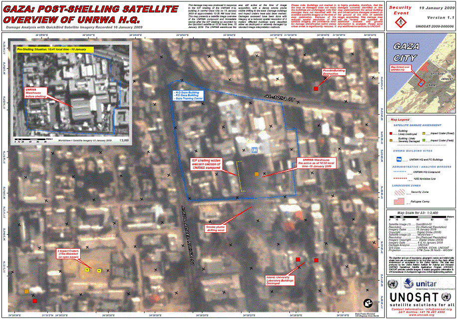
This damage map was produced in response to the IDF shelling of the UNRWA H.Q. building in central Gaza City on 15 January 2009 at approximately 10:30 AM local time. This map presents a satellite image overview of the UNRWA compound and immediate vicinity after the IDF shelling as recorded by the Quickbird satellite at 10:30 local time, 16 January 2009. The UNRWA warehouse fire was still active the time time of image acquisition, with a dense smoke plume visible drifting to the west. Damage buildings and impact craters have also been marked. Damages assessed have been done with imagery at a reduced spatial resolution of 2 meters. Affected buildings were classified either as destroyed or severely damaged by standard image interpretation methods.
Please note: Buildings not marked in the map as damaged does not imply the buildings are undamaged, only that damages were not identified with the available satellite imagery at the time of map publication. Because of the reduced spatial resolution of this satellite imagery, the confidence level for damage identification within dense urban areas is significantly reduced. It is highly probable, therefore, that the damages currently identified in this map underestimate the actual building and infrastructure damages present on the ground at the time of satellite image acquisition. This damage map will be revised and updated as additional analysis and ground information is available. Please send any additions/correctsions to UNOSAT.